
Focus Around the world
This article is over 3 years old
United Kingdom, the heat map: will water be the future of heating systems?
According to the heat map by DECC, heating and hot water will be derived from national hydric resources soon, applying the technology of geothermal heat pumps to watercourses.
From the land that gave birth to Harry Potter, comes yet another "magic", as stated by Ed Devay, Secretary of the British Department for Energy and Climate Change (DECC), the body responsible for monitoring the energy supply and fight against global warming.
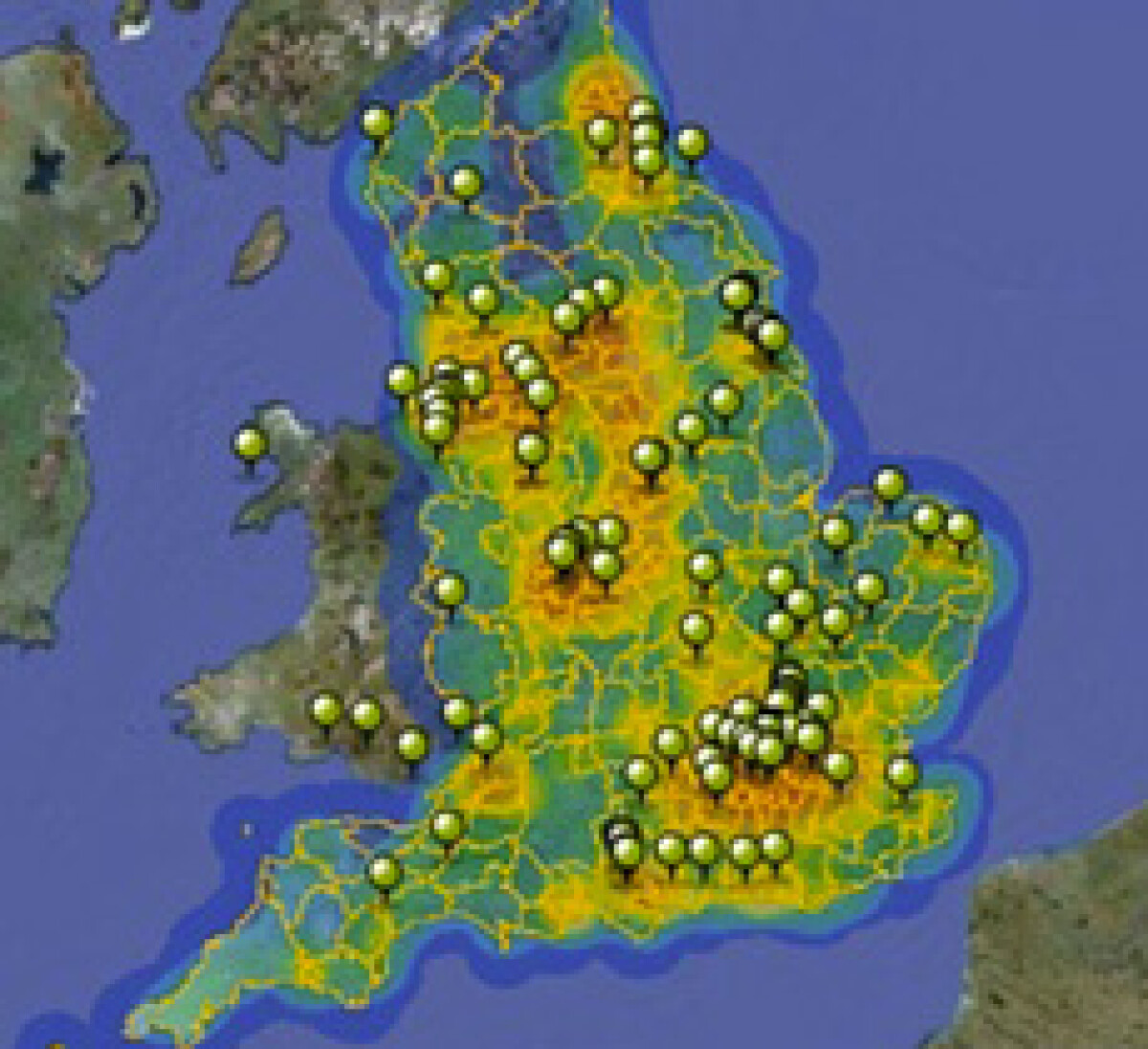
The "magic" in question relates to the recent publication of a map, unique in its kind, on the Department’s website, regarding the geographical distribution of the English rivers that may be used for heat exchange.
The National Heat Map identifies the areas adjoining the 40 urban rivers and estuaries running through England, which seem to be ideal for supplying hundreds of English homes and commercial buildings with heating and hot water.
Applying the technology of geothermal heat pumps to watercourses, it would be possible to supply local heating systems with a low-carbon and renewable energy source, in substitution of conventional gas fired or electric domestic heating systems, notoriously more polluting.
The estimated overall capacity of such geothermal heat pumps would be about more than 1MW, which is enough to satisfy the need for heating and hot water of about 400-500 homes.
Currently in England, the heating systems for buildings and houses are mostly centralized, while the few insulated heat sources can cover just 2% of the demand, which is why the British government seems to be strongly oriented to the development of this technology.
The purpose of the map is essentially to provide assistance to local authorities, private developers and communities, in order to identify the best places to install new water source heat pump plants, thus combining the availability of water resources with adequate population density.
Therefore, it represents an excellent business opportunity, but also an intelligent and innovative energy project. In fact, only in March 2014, the British Energy Department announced that £2.1 million had been awarded to 24 local authorities in England and Wales (including the city councils of Leeds, Manchester, Newcastle and Sheffield), to support their pioneering projects for district heating.
"The National Heat Map represents a big step forward in the use of the web to provide intelligence and support for the development of local energy projects," said Joshua Thumim, CSE’s (Centre for Sustainable Energy) head.
With regards to this initial phase, the map is just a useful tool to define the areas potentially suitable for hosting this kind of systems; a more detailed analysis and in situ investigation will later be needed, however, in order to ascertain the most advantageous zones, from an economic, a social and environmental perspective.
Italy itself, with its 69 lakes and more than 234 rivers, mostly concentrated in Piedmont, Tuscany and Lombardy, is among the richest countries in Europe for water supply.
One can only imagine the benefits that such a map, if translated and adapted to Italy and its conformation, could bring. Through the use of an equally reliable and efficient technology, in fact, it would be possible to extract heat from the many rivers, estuaries, reservoirs and lakes crossing the Boot, and to convert that energy into thermal heating and hot water for homes or offices.
It would be, of course, clean energy, environmentally friendly, which could free Italy from its traditional dependence on fossil fuel imports, finally allowing it to boost home-grown energy supplies.
